Monmouth County Surf Forecast
Last Update: 12/09/2025 09:30
Link to Free Surf Cams: Beach Cams
Scroll to the right for more information in the below tables
Week of 12/7-12/14
The Outer Banks is looking interesting around 12/7-12/9 if you have the opportunity to head out of town.
That setup for 12/10 looks like it’s going to be working out, at least partially. We should see some surf from a interaction between a high pressure system in the central Atlantic with a low pressure system moving over the Great Lakes. The southward shift in the storm track didn’t materialize the way the models had been showing earlier this month. Due to that, we’re going to get another steep angled swell that is mostly aimed southwest.
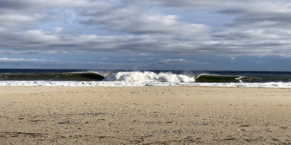
The only days worth watching this week are Wednesday/Thursday 12/10-12/11 and potentially 12/14.
Wednesday 12/10
See the detailed forecast here
| Time | Swell Height | Period | Wave Direction | Energy Percentile | Wind Speed | Wind Direction |
|---|---|---|---|---|---|---|
| 07:00 | 6 | 6.3 | 194 | 32.2 | 24.8 | SSW |
| 10:00 | 7.9 | 6.8 | 188.6 | 55.4 | 30.8 | SSW |
| 13:00 | 8.3 | 7.2 | 184.6 | 65.7 | 28 | SSW |
| 16:00 | 7.7 | 7.8 | 181 | 71.4 | 22 | SW |
| 19:00 | 7.1 | 8.1 | 180.8 | 71 | 24 | SW |
| Time | Tide | Height (ft) |
|---|---|---|
| 04:57 | L | 0.45 |
| 11:25 | H | 4.53 |
| 17:45 | L | 0.1 |
Swell starts to come in from that low pressure system over the Great Lakes. We have strong south winds that will be too much for almost all breaks in the area. The timing of the low tide works out well for a late afternoon session if it comes together.
Model swell heights are still bouncing around some. This output is quite a bit stronger than the last few days, but it does seem to be trending stronger as we get closer. Take this with a grain of salt, but we might have some pretty fun surf for the afternoon with wind being the limiting factor.
Wave heights are likely to be around shoulder high on average with larger sets here and there.
Notes: Sideshore wind during daylight hours. Timing is easier with less of a tide swing than last week. Beginners and newer surfers should know their limits.
Best board: daily driver/shortboard
Thursday 12/11
See the detailed forecast here
Swell table is a bit misleading
| Time | Swell Height | Period | Wave Direction | Energy Percentile | Wind Speed | Wind Direction |
|---|---|---|---|---|---|---|
| 07:00 | 5.3 | 8.1 | 178.2 | 59.5 | 27.4 | WNW |
| 10:00 | 4.7 | 4.5 | 311.3 | 0.1 | 22.5 | WNW |
| 13:00 | 4.5 | 4.4 | 294.4 | 0 | 25.3 | W |
| 16:00 | 4.3 | 4.5 | 292 | 0 | 24.6 | W |
| 19:00 | 4.6 | 4.5 | 275.5 | 0 | 27.5 | W |
| Time | Tide | Height (ft) |
|---|---|---|
| 00:13 | H | 4.18 |
| 05:57 | L | 0.7 |
| 12:19 | H | 4.24 |
| 18:45 | L | 0.27 |
I’m hoping the wind forecast comes down a bit. Given the short period swell, it’d be better to see lighter winds. Best surf will be in the early AM on the incoming tide, but it’s too early to get into wave height at this point. From what I’m looking at, waist-stomach high is a reasonable estimate with potentially larger surf in the early AM. Surf is expected to drop very quickly.
The swell table above is misleading. There will be some SE swell pretty much all day, but it gets unsurfably small (given the wind) by 1pm or so.
Notes: Conveniently timed low tide for the AM. Wind is forecasted to be pretty strong which isn’t ideal. If the wind is as strong as forecasted, a bigger board will be the call after early AM. Surf drops quickly.
Best board: Groveler for the early AM and a longboard after.
Friday 12/12
Flat. It looked like we might get something here a few model runs ago, but it’s not looking like that’ll be the case.
| Time | Swell Height | Period | Wave Direction | Energy Percentile | Wind Speed | Wind Direction |
|---|---|---|---|---|---|---|
| 07:00 | 3.4 | 4.2 | 270.2 | 0 | 19.3 | W |
| 10:00 | 2.4 | 3.7 | 271.7 | 0 | 15.1 | W |
| 13:00 | 2 | 3.2 | 261.2 | 0 | 14.6 | W |
| 16:00 | 1.7 | 3.1 | 259 | 0 | 12.8 | W |
| 19:00 | 1.4 | 2.9 | 251.4 | 0 | 11.6 | WSW |
| Time | Tide | Height (ft) |
|---|---|---|
| 01:01 | H | 4.17 |
| 07:03 | L | 0.81 |
| 13:13 | H | 3.98 |
| 19:39 | L | 0.36 |
Saturday 12/13
Flat.
Sunday 12/14
I’d check back to see if we get anything from a coastal low moving off North Carolina. Models aren’t showing anything from this, but it’s possible we get a short lived swell.
| Time | Tide | Height (ft) |
|---|---|---|
| 02:43 | H | 4.25 |
| 09:03 | L | 0.68 |
| 14:55 | H | 3.62 |
| 21:09 | L | 0.4 |
Notes: Probably flat
Looking Ahead
The next time period to watch is around 12/19. Models are showing a large high pressure system in the central atlantic that could generate some surf and a low pressure system that is too far north to generate swell, but large enough to potentially give us some offshore winds. It’s too early for details, but it could be interesting. I’d expect at least some choppy surf from the high pressure system with unfavorable winds.
After that, there’s a decent looking chart for around Christmas with what could be a Nor’easter and a fairly strong high over the Canadian Maritimes. That would be a really nice setup for our region if it comes to pass.
Beach Cams (links to thesurfersview.com) Beach Cams
Current list of Surf Hazards Surf Hazards
Why Energy Percentile? Energy Article